Quantifying the impact of vegetation on urban temperature using remote sensing
Summary
The growing environmental awareness of society, combined with the rapid advancement of geoinformation technologies, is generating an increasing demand for accurate data on the state of the urban environment. Urban greenery plays a crucial role as a reservoir of biodiversity for humans, animals, and insects. Moreover, it significantly contributes to air temperature regulation, oxygen production, carbon sequestration, and enhancing cities' resilience to climate change's impacts. These functions are particularly important in the context of the urban heat island effect—a phenomenon characterised by a faster rate of temperature increase in urban areas compared to non-urban surroundings. Kraków, one of the most polluted cities in Europe, offers an excellent model for studying the influence of vegetation on urban temperature. Trees occupy 36% of its surface area, while grasslands cover 20%. There is a lack of interdisciplinary studies that comprehensively quantify the impact and potential of different plant species and their physiological mechanisms in regulating urban temperatures.
Therefore, the scientific objective of this project is to generate new knowledge on how individual plant units affect localised temperature changes in urban environments, using Kraków as a case study. The research will apply advanced, interdisciplinary, remote sensing methodologies. The project involves, among other tasks, a comparison of plant species with “cooling,” “thermally neutral,” and “warming” effects, as well as an analysis of their interactions with urban infrastructure through the integration of field and laboratory measurements, multispectral and thermal imaging, chlorophyll a fluorescence assessments, and satellite data. Furthermore, the project aims to develop a catalogue of plant species demonstrating the highest efficiency in reducing ambient temperatures, along with strategic maps identifying optimal locations for the establishment of new green enclaves to mitigate the urban heat island effect.
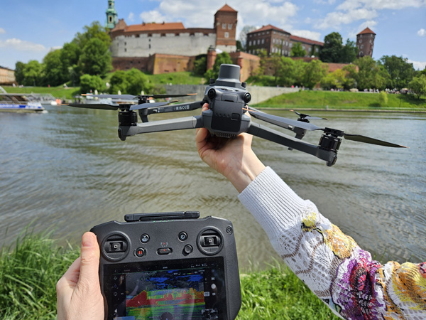
Drone with multispectral camera.
Photo: Marek Hebda.
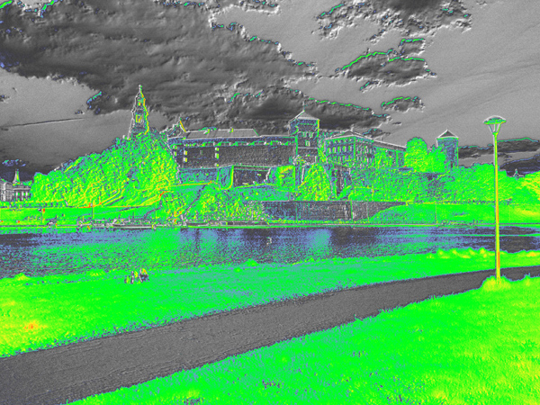
Wawel Castle in a spectral camera calibrated to detect green areas (NDRE index).
Photo: Magdalena Szechyńska-Hebda.
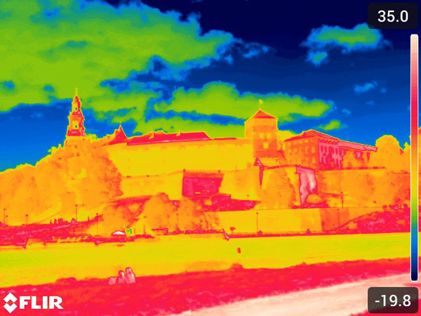
Wawel Castle in a thermal imaging camera.
Photo: Magdalena Szechyńska-Hebda.

Project logo.
Photo: pxhere.com, modified.